Next 72 hours · summit band · issued Sun 12:55 PM MST
Every flake, base to summit.
415 lift-served ski areas, measured from their own lifts and forecast in 500-foot bands. Totals, the rain/snow line and the spread between models for every mountain in the Lower 48, updated hourly.
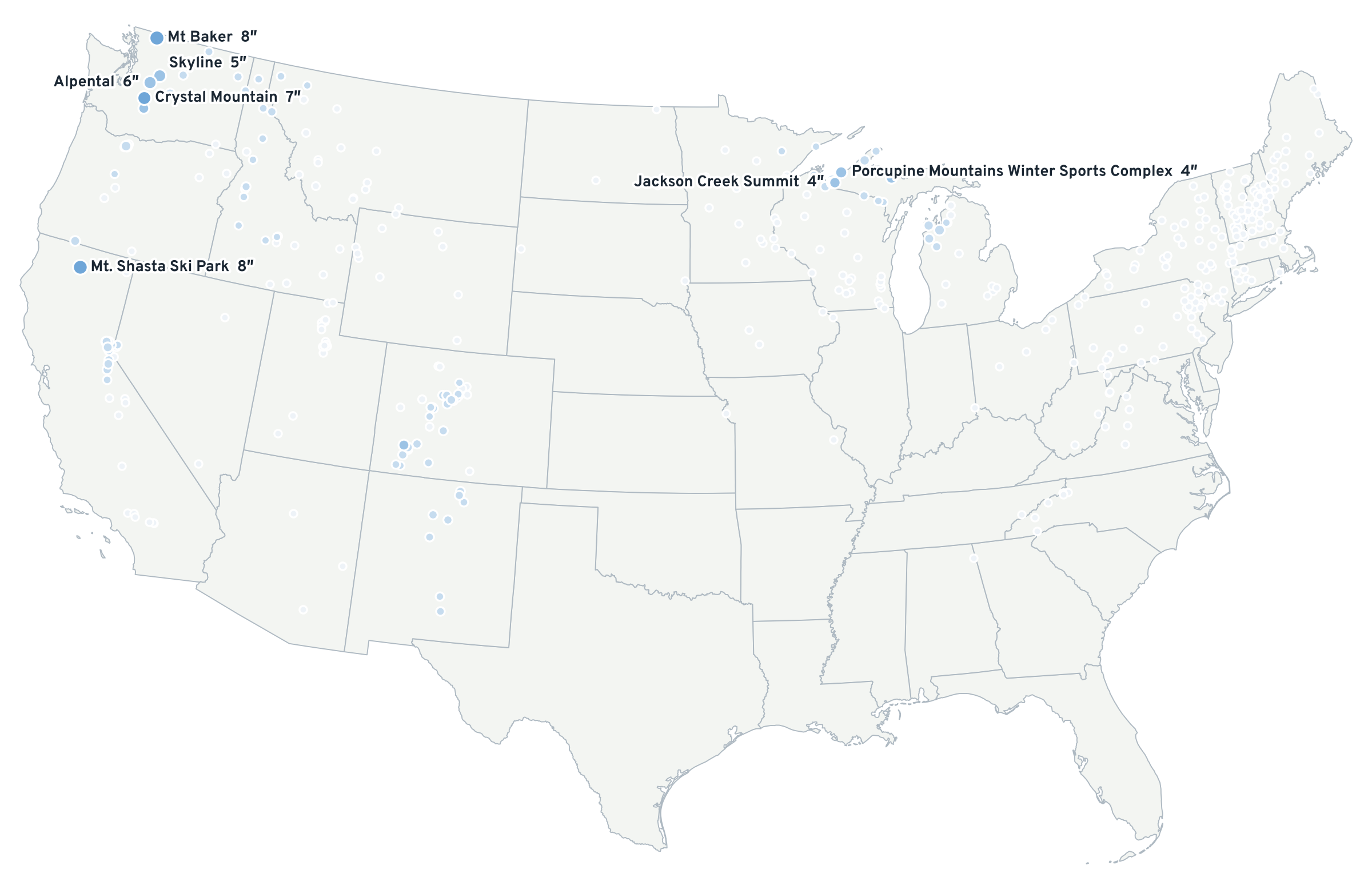
By region
Summit band, next 72 h · confidence from the 10th–90th percentile spread| Region | Areas | Best 72 h | Over 12″ | Snow line | Confidence |
|---|---|---|---|---|---|
| Sierra Nevada | 30 | Mt. Shasta Ski Park 8″ | 0 | 4,700 → 6,600 ft | High |
| Wasatch | 19 | Alta Ski Area 0″ | 0 | — | High |
| Tetons and Idaho | 28 | Brundage Mountain 1″ | 0 | — | High |
| Northern Rockies | 17 | Lookout Pass 1″ | 0 | — | High |
| Colorado | 33 | Telluride Ski Area 3″ | 0 | — | High |
| Southwest | 11 | Pajarito Mountain 1″ | 0 | — | High |
| Cascades | 25 | Mt Baker 8″ | 0 | 2,400 → 5,100 ft | Low |
| Lake effect | 74 | Porcupine Mountains Winter Sports Complex 4″ | 0 | — | High |
| Upper Midwest | 12 | Chestnut Mountain Resort 0″ | 0 | — | High |
| Northeast | 115 | Bristol Mountain Ski Resort 0″ | 0 | — | High |
| Mid-Atlantic | 33 | Mount Pleasant of Edinboro 0″ | 0 | — | High |
| Southeast | 18 | Cloudmont Ski Hill 0″ | 0 | 10,400 → 7,600 ft | High |
Browse by state
Alabama 1Arizona 3California 26Colorado 33Connecticut 5Idaho 18Illinois 1Indiana 1Iowa 3Maine 15Maryland 1Massachusetts 10Michigan 27Minnesota 17Missouri 2Montana 17Nevada 4New Hampshire 25New Jersey 3New Mexico 8New York 34North Carolina 6North Dakota 3Ohio 4Oregon 12Pennsylvania 29Rhode Island 1South Dakota 2Tennessee 1Utah 19Vermont 27Virginia 5Washington 13West Virginia 5Wisconsin 24Wyoming 10 All 36 states
The mountain is a column, not a point
Measured from the lifts. Forecast band by band.
Base and summit come from the lowest and highest lift terminal on 4,183 lifts. Temperature comes from each model's own vertical profile, because the summit is warmer than the base on 22.5% of winter days. Precipitation is carried onto terrain with PRISM.
How the forecast is made- Ski areas
- 415
- Elevation bands
- 1,314
- Median error vs. published vertical
- ±50 ft
- Winter days the summit is warmer
- 22.5%